 APK")
FLY is FUN is developed by pilots, for pilots. FLY is FUN simplifies flight preparation, improves knowledge of the air environment during flight by displaying information on airspace, reporting points, geographical location on a map, relief, terrain, frequencies, tracks … facilitates access to PDF documents linked to land. The app also displays NOTAMs and rain radar data.
FLY is FUN allows ILS, VOR, NDB, DME, Marker beacons, RNAV alerts and Marker beacons without ILS / VOR / NDB / RNAV equipment.
FLY is FUN can be tried for free for a few days. At the end of the trial period, you must take out an annual subscription. The subscription covers the development costs of FLY is FUN.
FLY is FUN allows you to:
| Create and modify routes via “drag and drop” and via the database
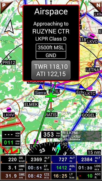
| Be alerted and have information before entering special controlled airspaces, passing special points …
|Calculate distances, flight time, estimated consumption (including wind and aircraft characteristics)
| Display route, course, track on the map
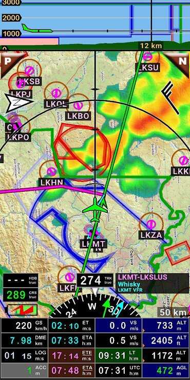
| Visualize airspaces
|Display dynamic relief map, with color according to ground height
| Create and export flight plans, navigation logs, routes,
| Create, export and import waypoints, tracks and airspaces (gpx, kml, Google Earth or OpenAir formats)
|Save the flight and replay it with Google Earth
| Calculate the times of sunrise and sunset
| Display weather information along the route
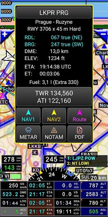
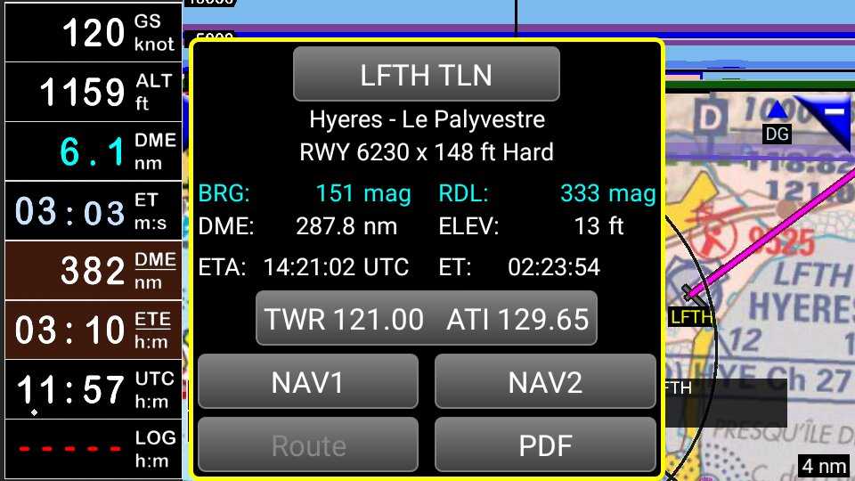
|Display information of selected points
| Calculate the distance between WPT
| View PDFs related to land (ex VACs)
…
The buttons of the 4 main screens are easily configurable. The pilot can choose the information to display:
| GPS and barometric altitudes
| Ground speed
|Cap
| Vertical speed
| Heading, distance, time remaining at point, at destination
|Time since departure
| Stopwatch
| DME, ACC, GS, ALT, TRK, BRG, AGL, ELE, CAL, VAR, UTC, LOG, HDG, CRS, ETA, ET, ETE, LT, MGS, GAL, SR, SS, XTK, PRE, QNH, VSI, RRD, SW1, SW2, RRD, DTA, DAL
…
The information displayed on the map can be configured according to the flight rules (VFR, IFR, VFR and IFR, etc.) and the zoom level
The integrated logbook can record:
| Departure and arrival times
| Departure and arrival grounds
|Trace of the flight with .kml or .gpx export and possibility of replaying in Google Earth
|Pilot and co-pilot of the flight;
| Device used
| Max measured ground speed
and calculate flight duration, distance traveled, average speed …
Maps and elevation data
Free original topographic maps from OpenStreetMap or OpenTopoMap and elevation data available for most countries in the world.
The user can create and use their maps in RMaps SQLite format, and import Slippy Mercator tiles. Thus the pilot can also use ICAO, Cartabossy, Skyvector, FAA charts, etc.
VACs and PDF files
VACs and PDF files can be loaded via the app for sites in more than fifty countries.
User can also import their own PDF files
Possible use of external GPS via Bluetooth.
User guide: http://www.funair.cz/downloads/manuals/flyisfun_en.pdf
If you have any questions and suggestions for improving the app, or if you find any bugs, please let us know through our website www.flyisfun.com.
♠ ♠ ♠ ♠ ♠ ♠ ♠
I invite you to join our official channel on Telegram to get the best exclusive free and paid apps
Telegram channel link:
![]()


![Netflix MOD APK [Premium Unlocked, 4K, No Ads]](https://w.mrapks.com/wp-content/uploads/2023/11/NETFLIX-MOD-APK2.webp)


Leave your rating for the product